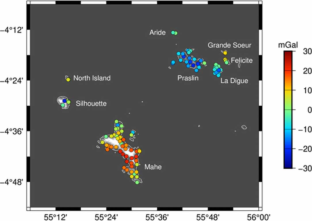
TeroMovigo has computed a new gravimetric geoid, called SeyGeoid2019, for the area around the Seychelles Islands Mahé and Praslin which will enable the direct conversion of GNSS ellipsoidal heights into official orthometric heights. A new regional model was necessary because the difference between recent global geoid models EGM2008, EIGEN-6C4 and XGM2019 demonstrate that these still have uncertainties larger than ±10 cm which is not sufficient for most surveying purposes. This improvement has been achieved by making 99 new terrestrial gravity observations. The gravity data have been corrected for the gravitational attraction of the topography and compared with the gravity disturbances according to three global geoid models. The benchmark B2 near the tide gauge on Mahé was used to link SeyGeoid2019 to the national vertical datum to ensure that the coincides with the mean sea level around the two main islands. The geoid has been produced in various digital formats that can be used by most GNSS software packages.